When Is the Best Time
The dry season especially July and August are the best time for hiking in Andingitra. However, rain can always occur in the eastern part of Madagascar. September and October are also dry but it gets hot in the daytime. Although the area around Andringita is a developed tourist region it gets seldom crowded in the National Park. During longer hikes, you have this beautiful area just to yourself.

Weather
Due to its different zones from humid tropical areas to high elevations (Pic Boby is 2658m/8720 feet high), you can expect temperatures ranging from 25°C/77°F down to -8°C/17°F with an average of around 21°C/70°F. The weather in the higher elevations can change quickly; be prepared for precipitation. January/February are the wettest months with precipitation on the east part of around 4000mm/year. July and August are relatively mild and dry. During the dry season is the chinook wind common for the area around Adringita. Although the daytime temps around the camp at Peak Boby could be pleasant 20°C/68°F in the sun you need to be prepared for freezing cold temps (-12°C/10°F) during the night due to the high elevation.

Average Monthly Temperature and Rainfall for MDG at location (-22.17,46.88) from 1991-2015
Best Months to Visit
Location and Tips

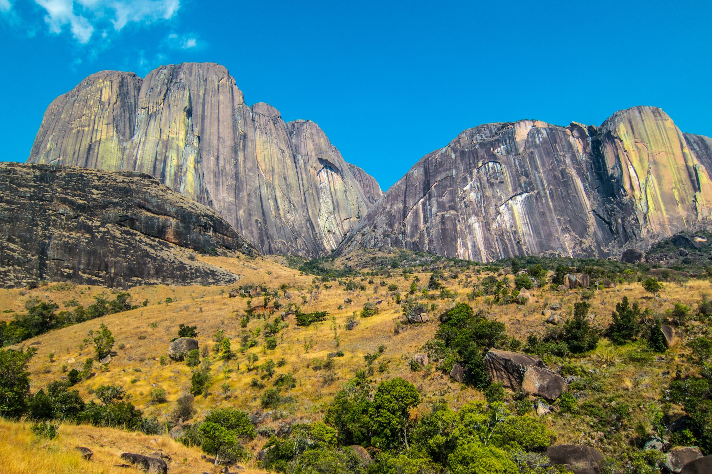
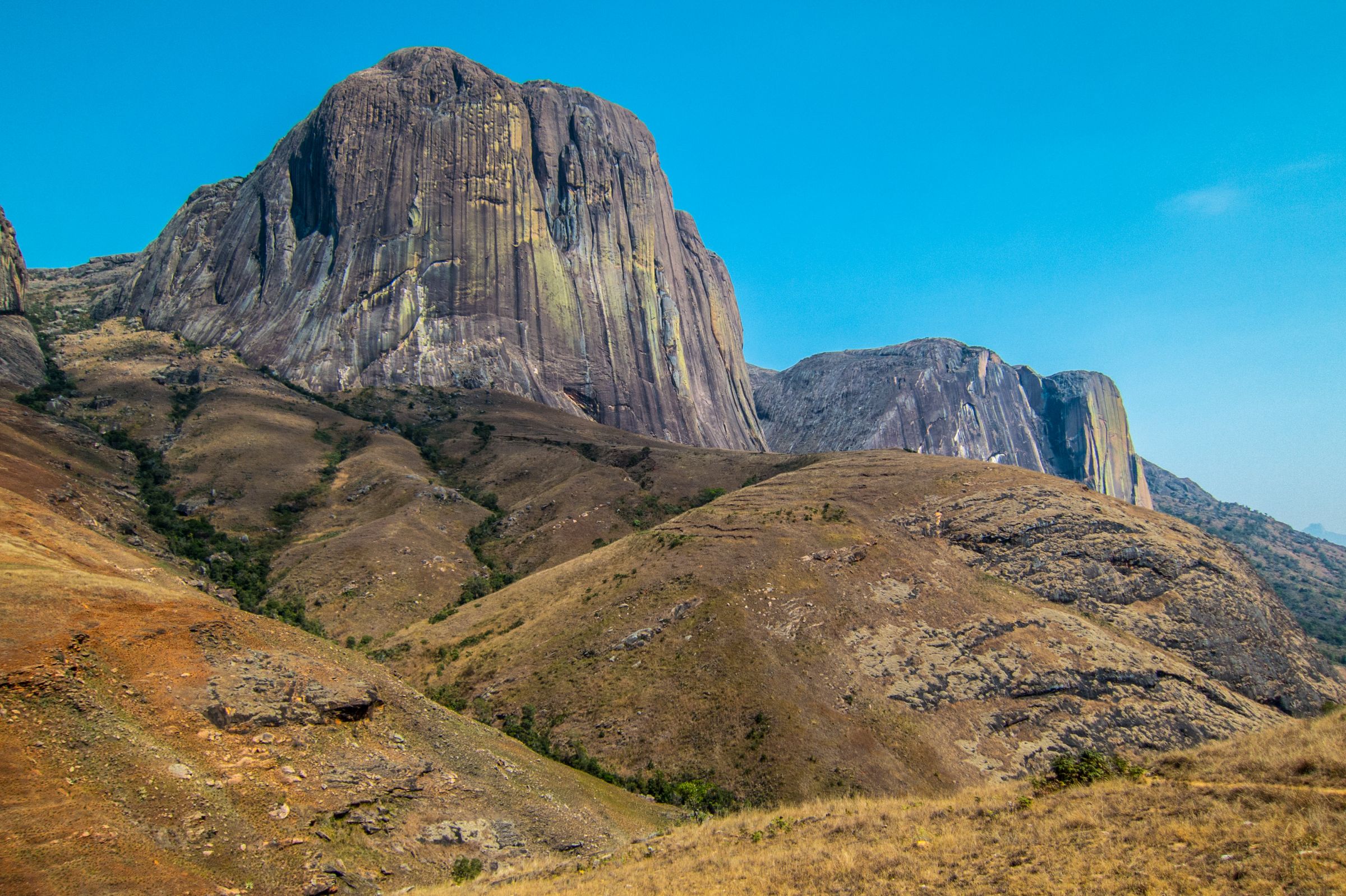
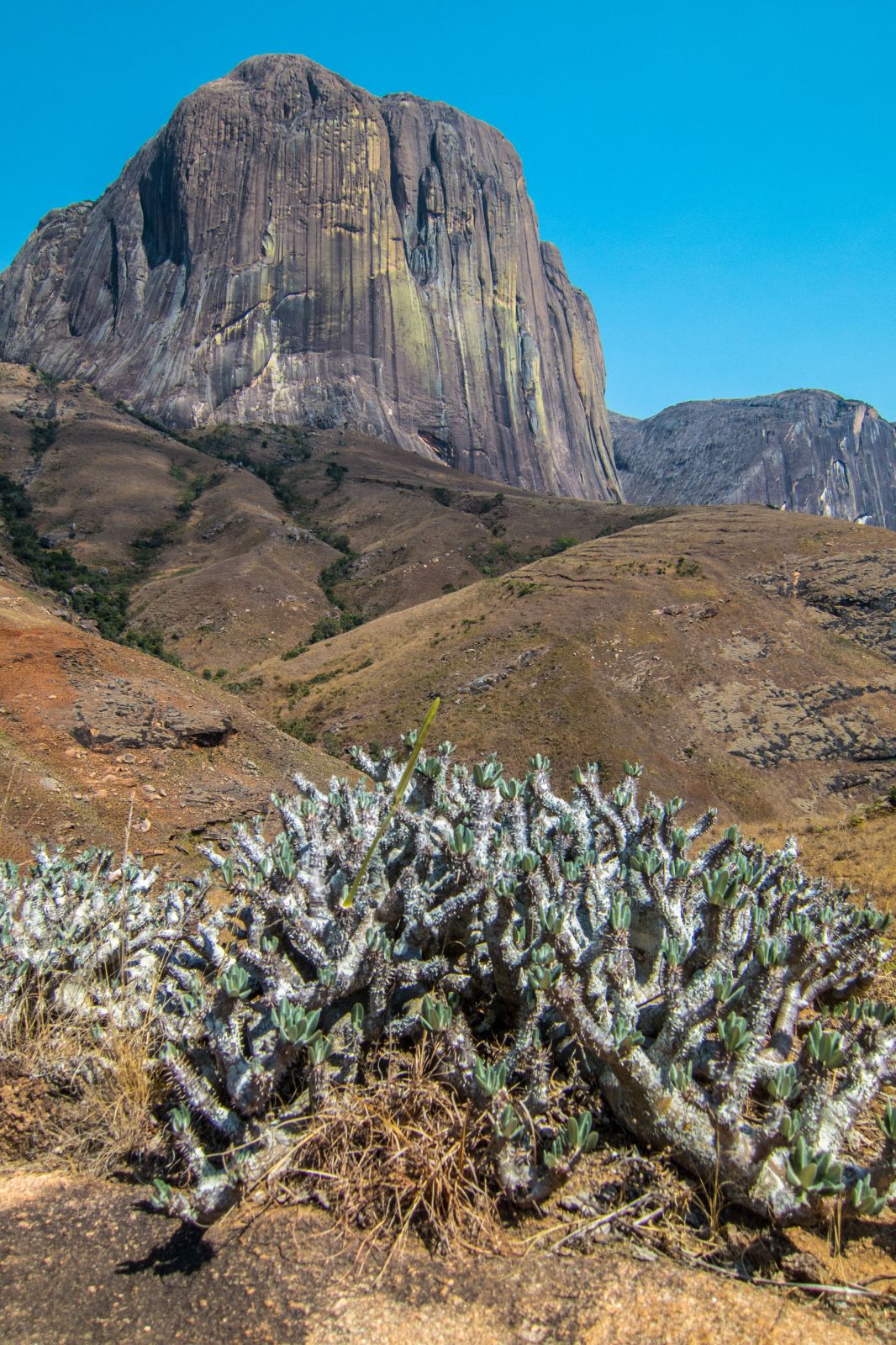
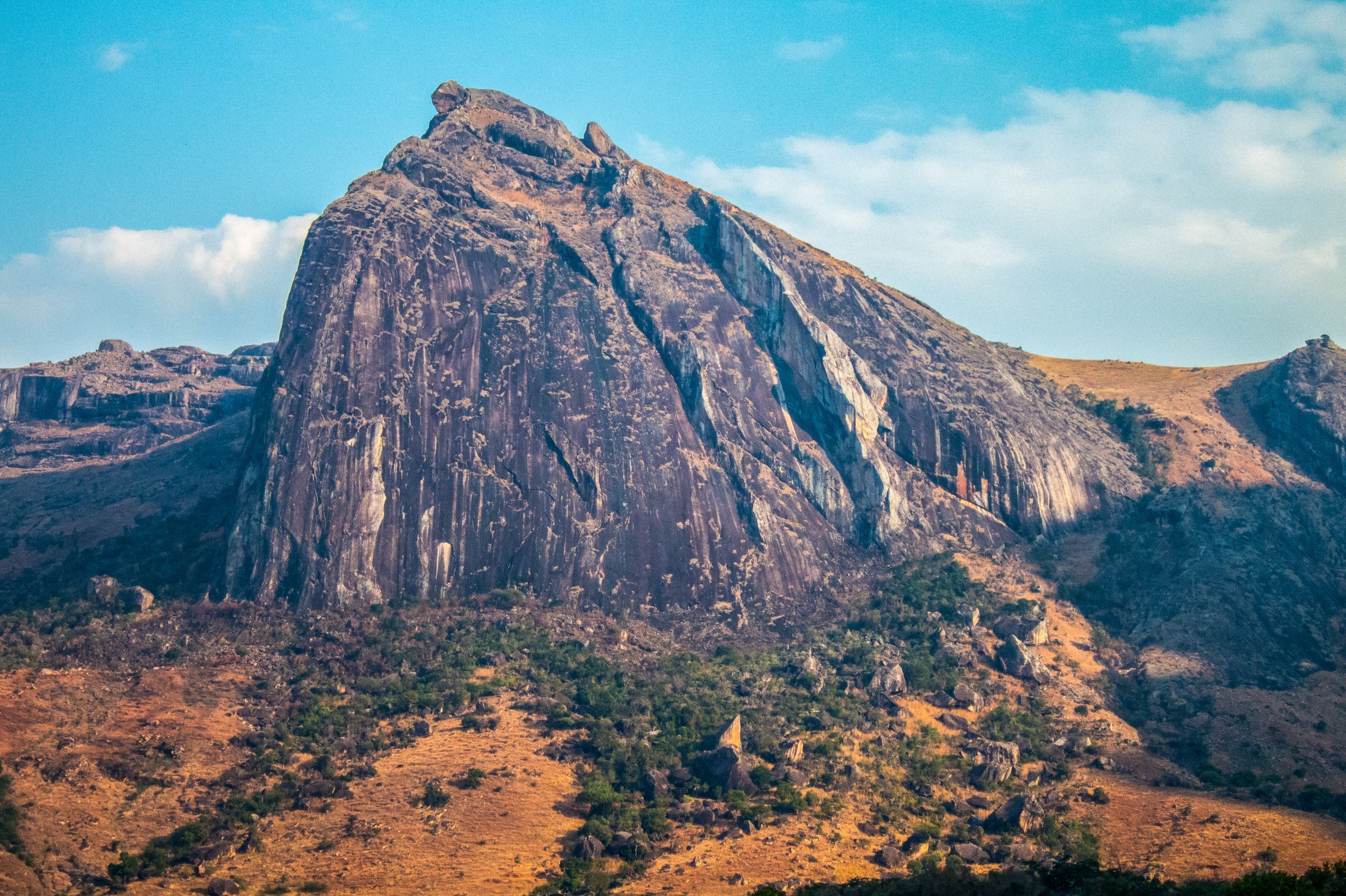
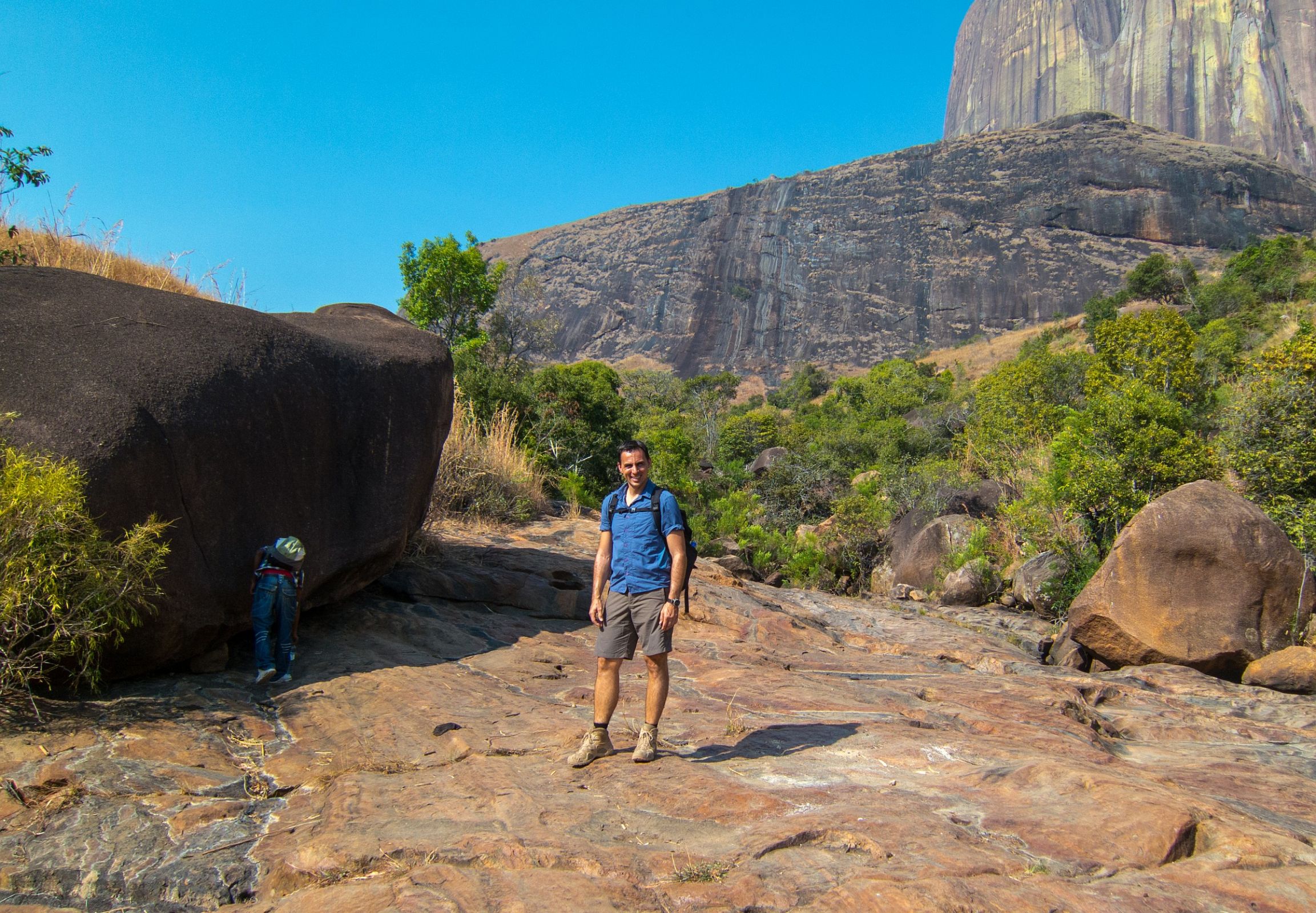
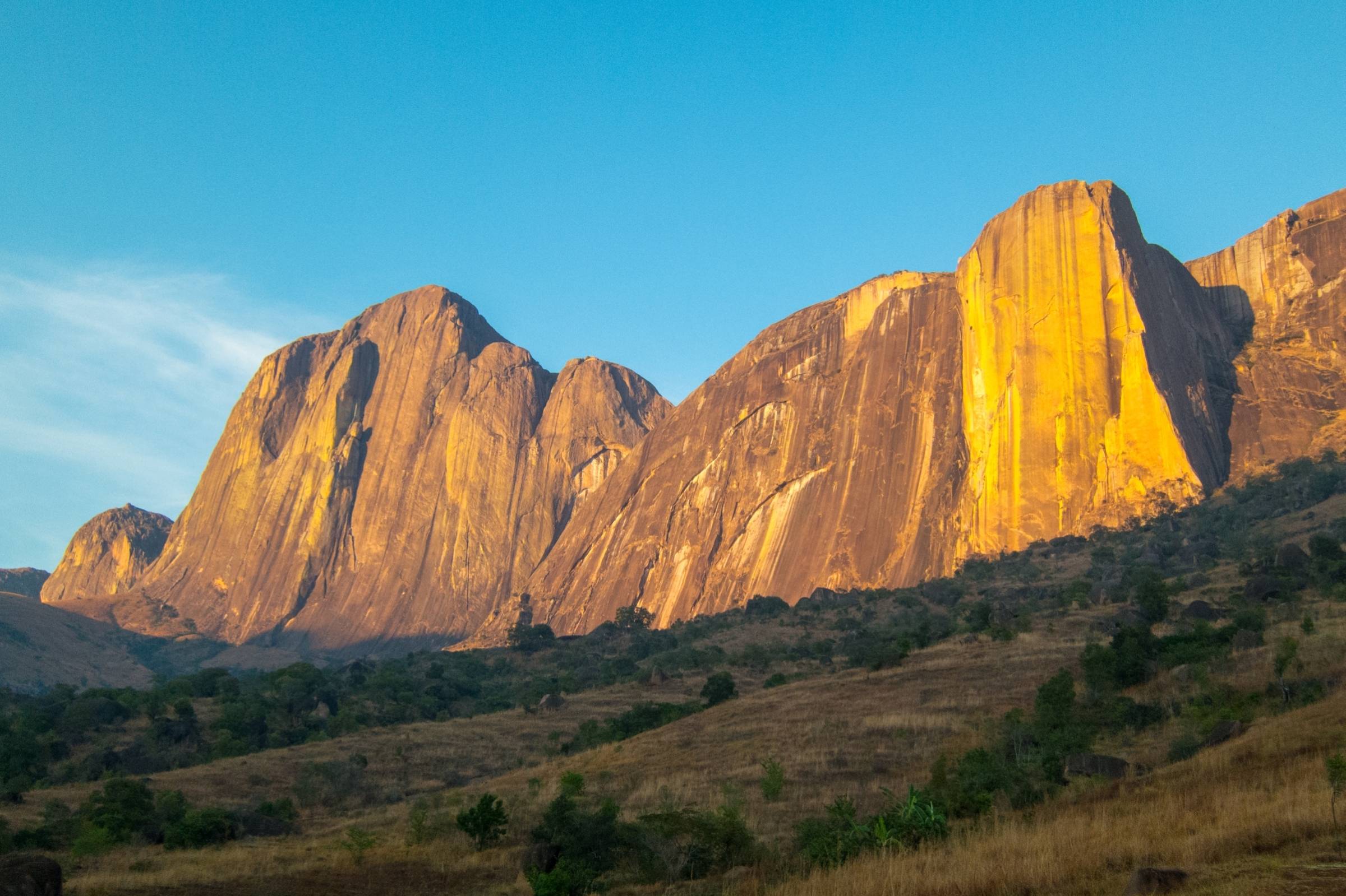
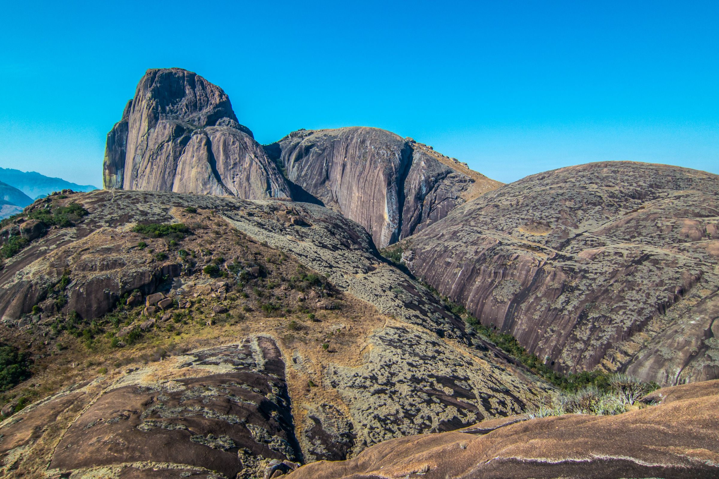
Andringitra National Park has been called the Yosemite of Madagascar due to the magnificent massifs that erupt right out of the ground. Although declared already in 1972 as Nature Reserve it was not well known to tourists and visitors until the 1990s as the area became a national park. In 2007 Andringitra was declared a UNESCO World Heritage Site. The park stretches over an area of 311km² /120 mile² and can be divided into three sections; each represents a unique ecosystem.

Our excellent guide Ndimby in Madagascar
From a rainforest at a low altitude, to mountain forest up to vegetation at a high altitude on the mountain range. The rainforest found here is part of the most extended remaining forest which stretches northbound from Ranomafana National Park until Peak Boby or Imarivolanitra, meaning close to the sky, the highest climbable mountain peak and second-largest in Madagascar in the south.
How to Get There
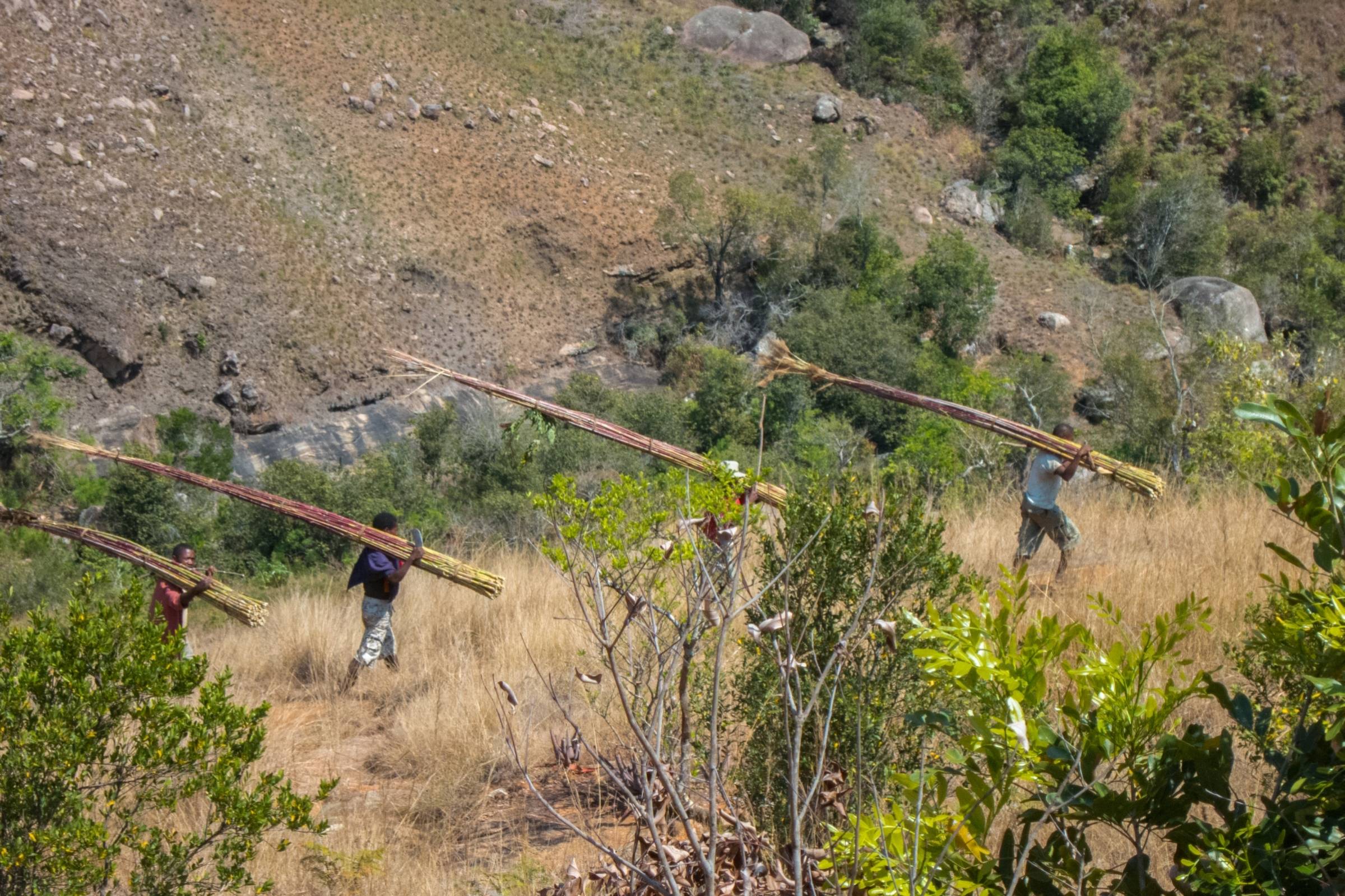
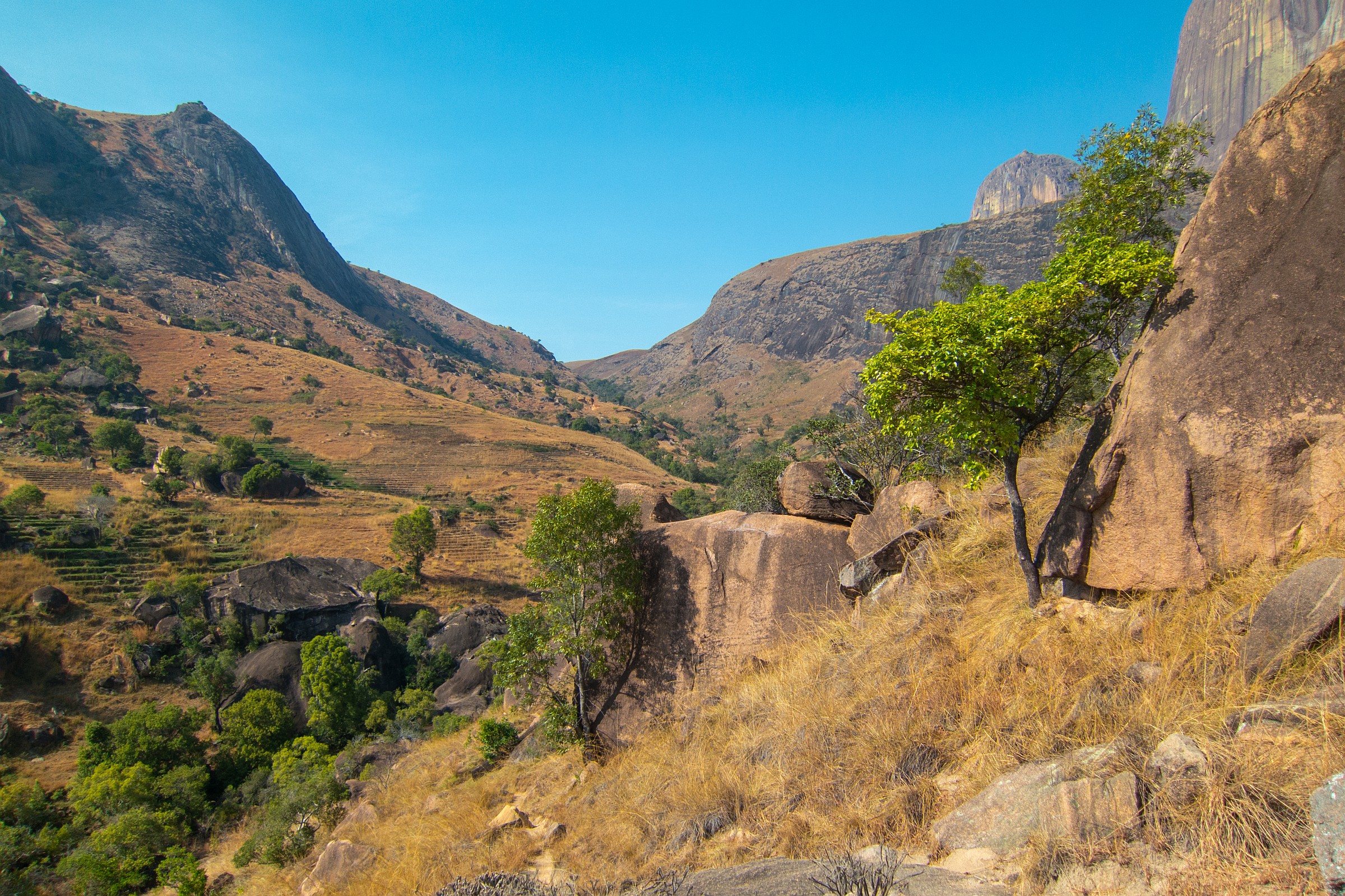
There are different roads to access the park by car if you arrive from Anja Community Village and Ranomafana. Either from Ambalavao to Antanifotsy or via the RN 7 heading towards Vohitsaoka. A 4 WD is required due to the bad road conditions. It may take up to 3 hours for a 45 km road. However, you need to hire a guide and/ or driver as no public transport is available.
What to See and Do

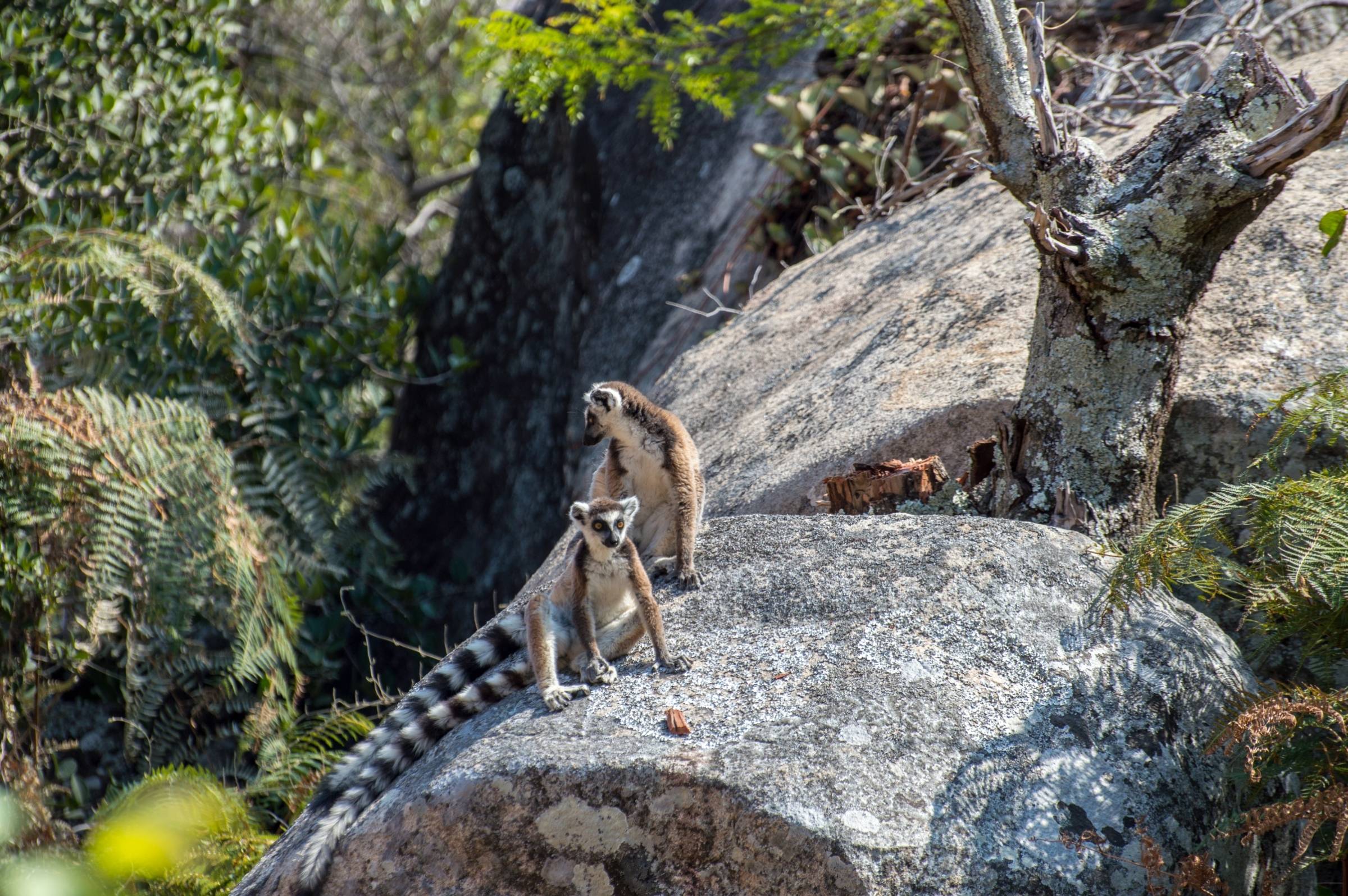
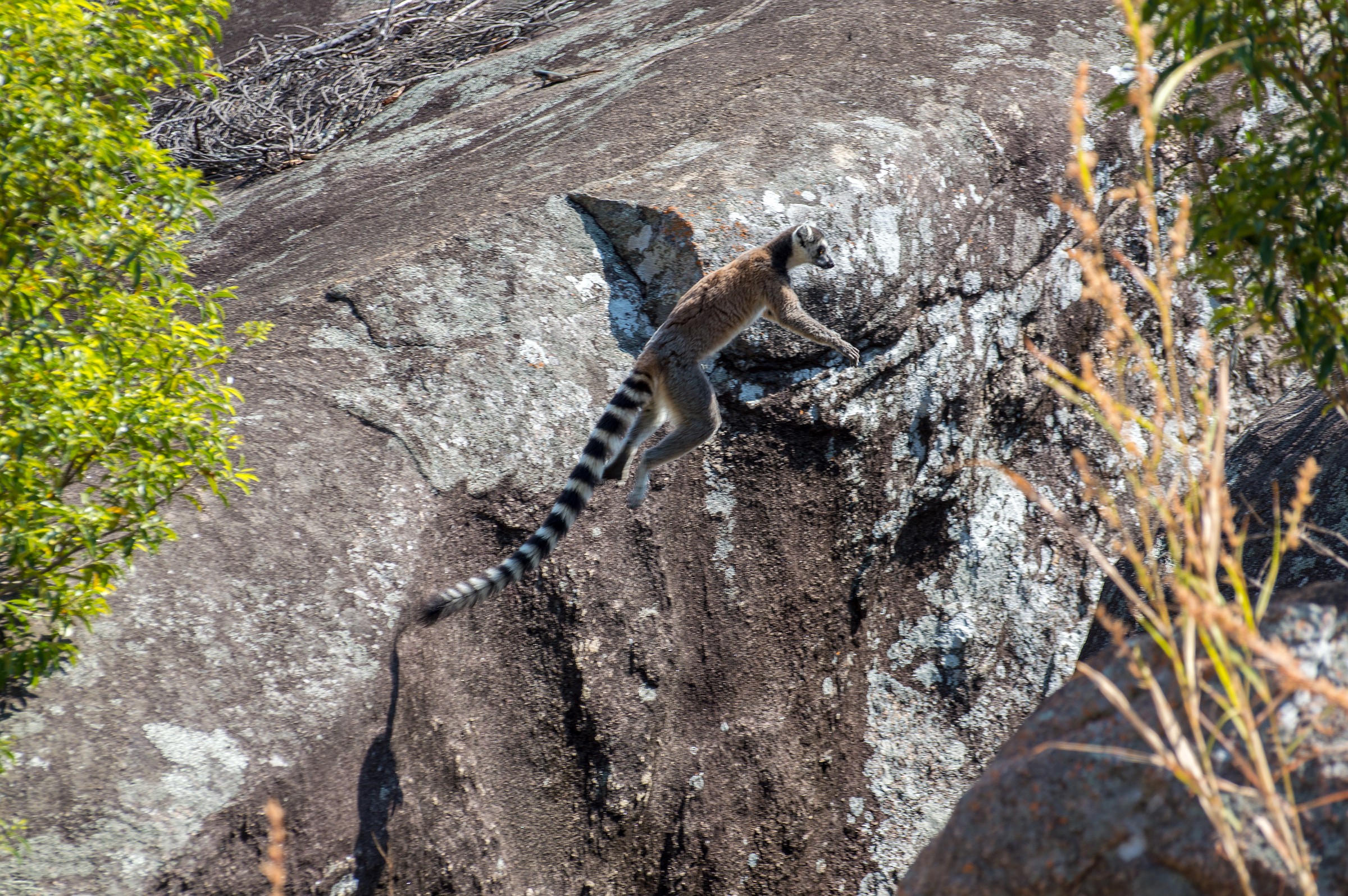
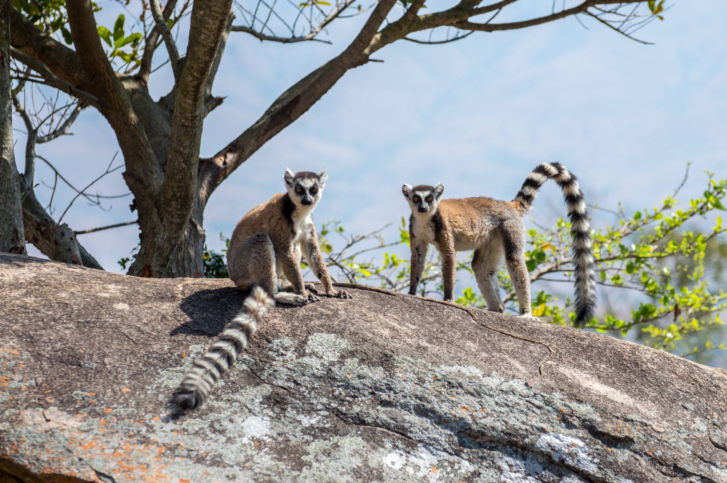
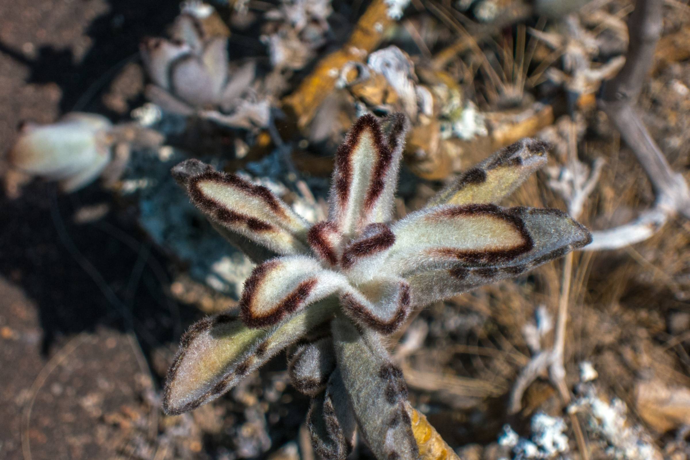
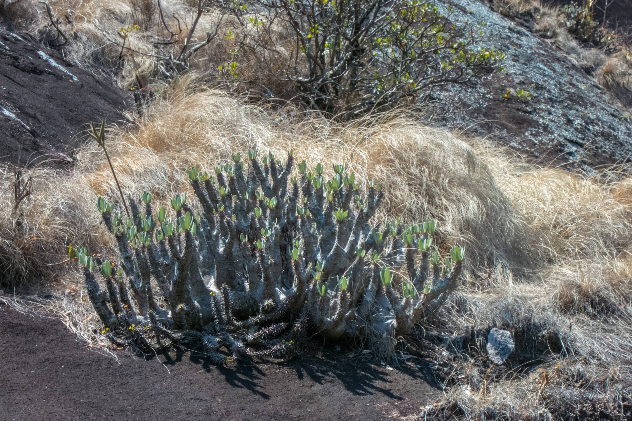
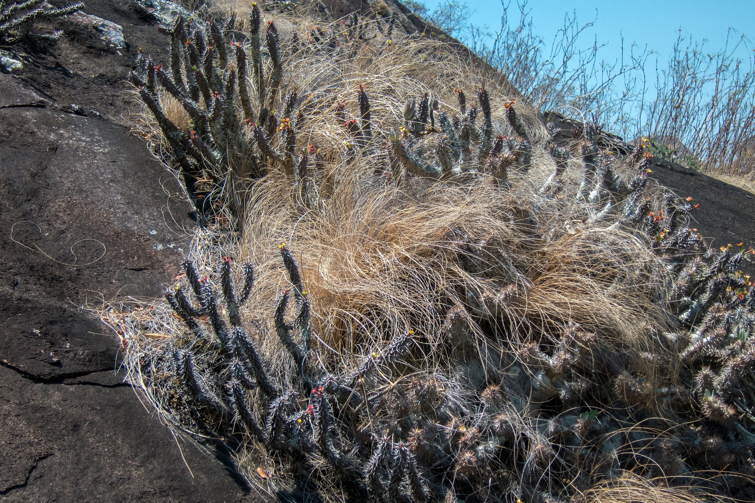
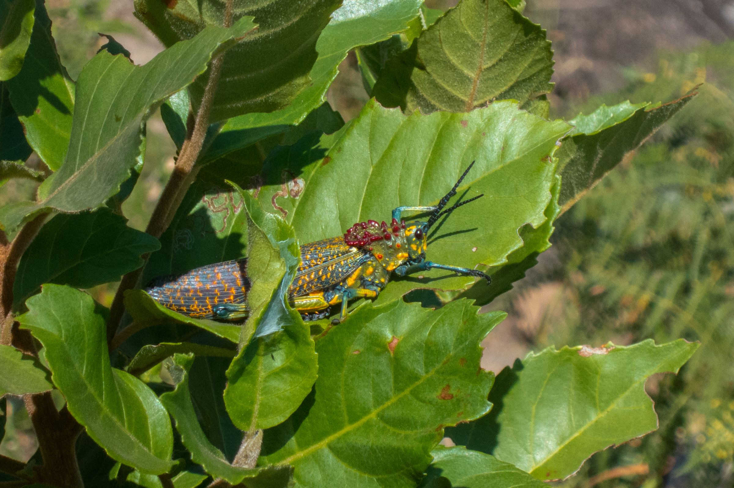
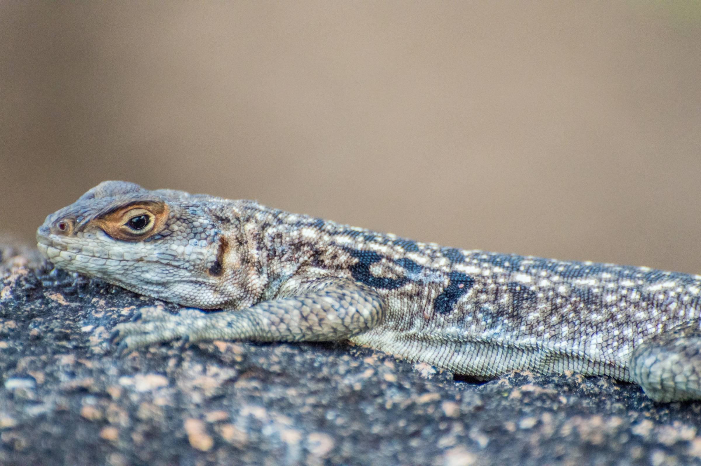
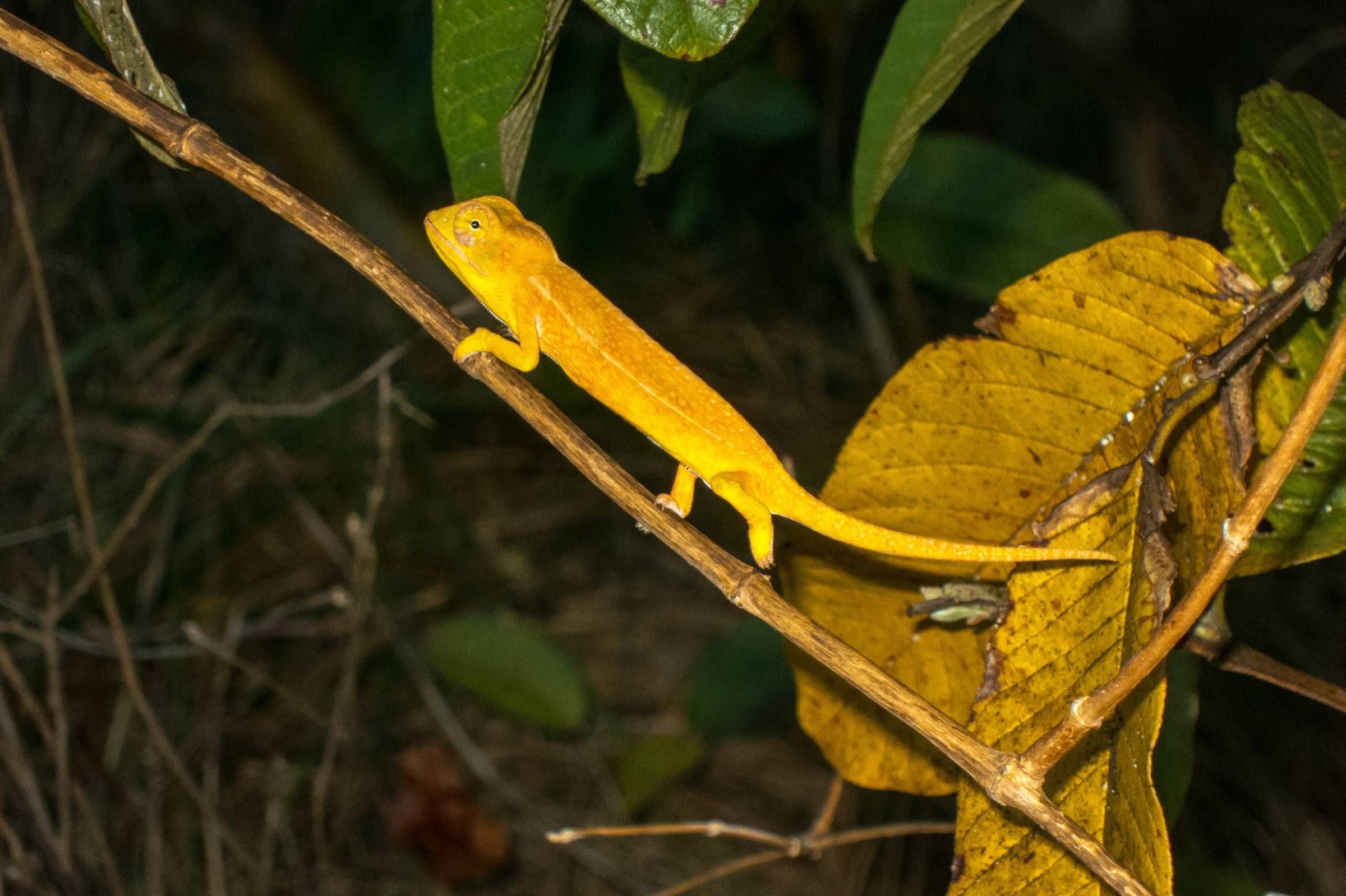
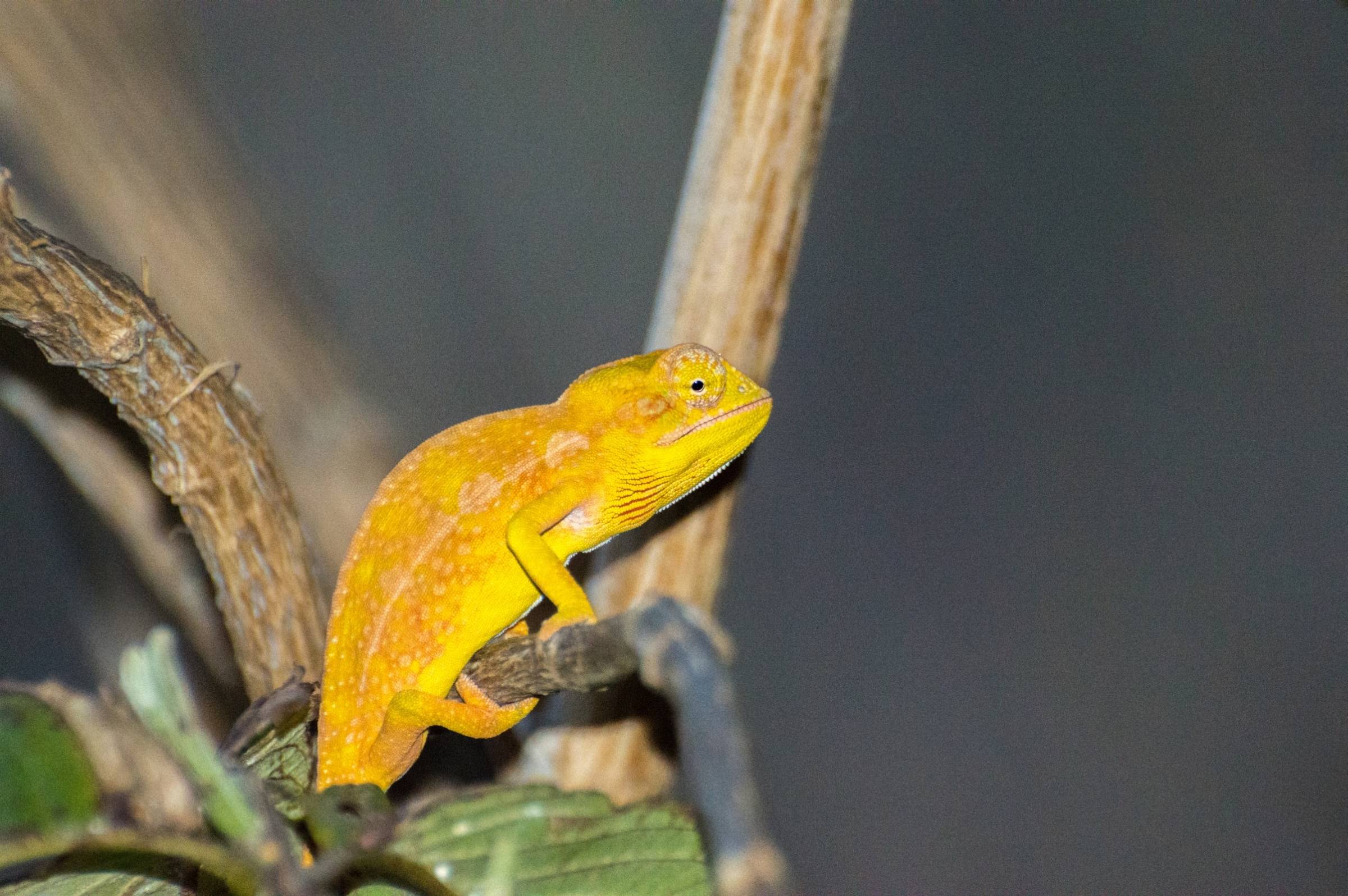
Andringitra National Park is one of the most biologically diverse and endemic places on the island. This biodiversity includes over 100 different birds, 50 species of mammals including 13 types of lemurs, more than 50 distinct species of frogs, and around 1000 different plants. The ring-tailed lemurs (catta) live close to the camps. Because of the low temperatures at night, their fur is thicker and darker compared to the cattas living elsewhere.

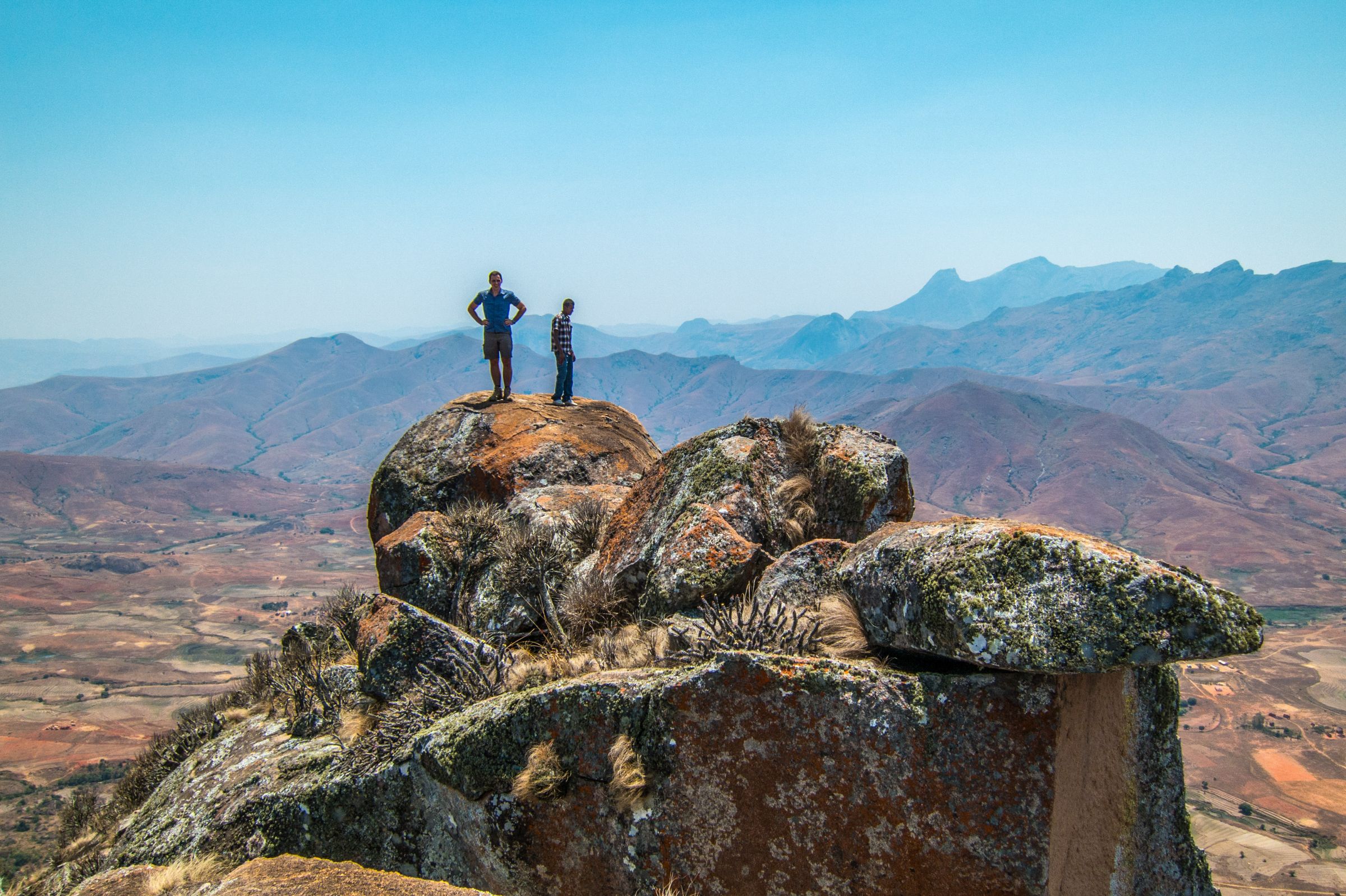
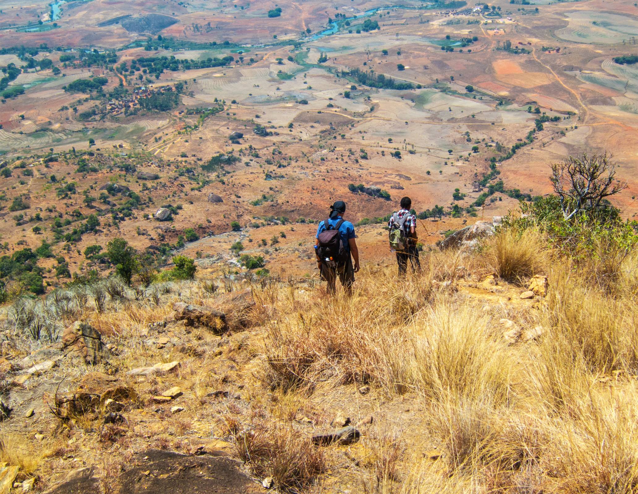
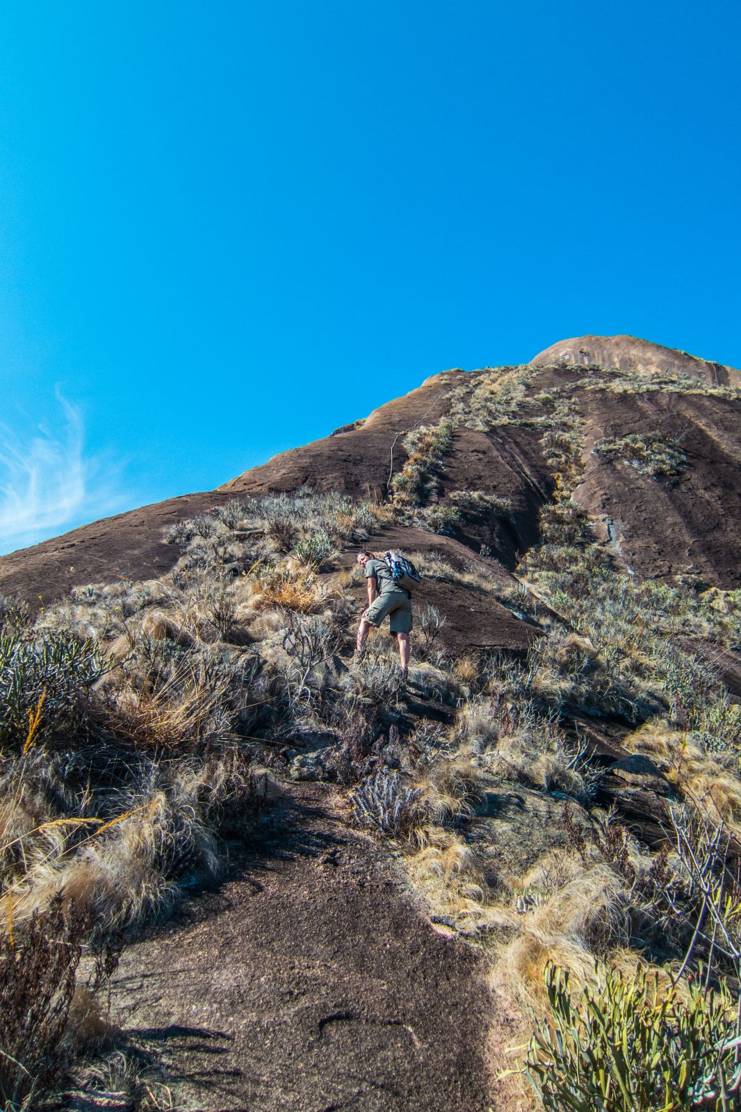
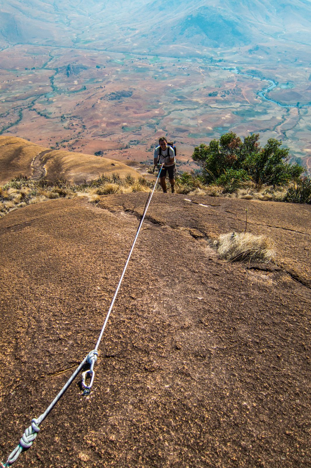
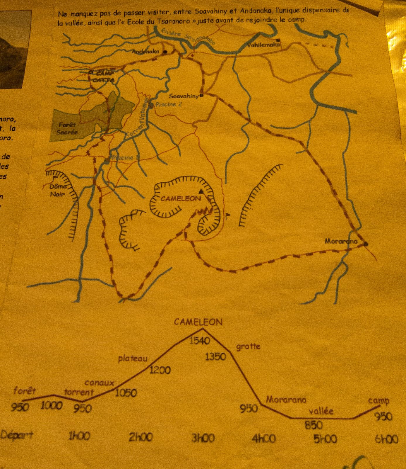
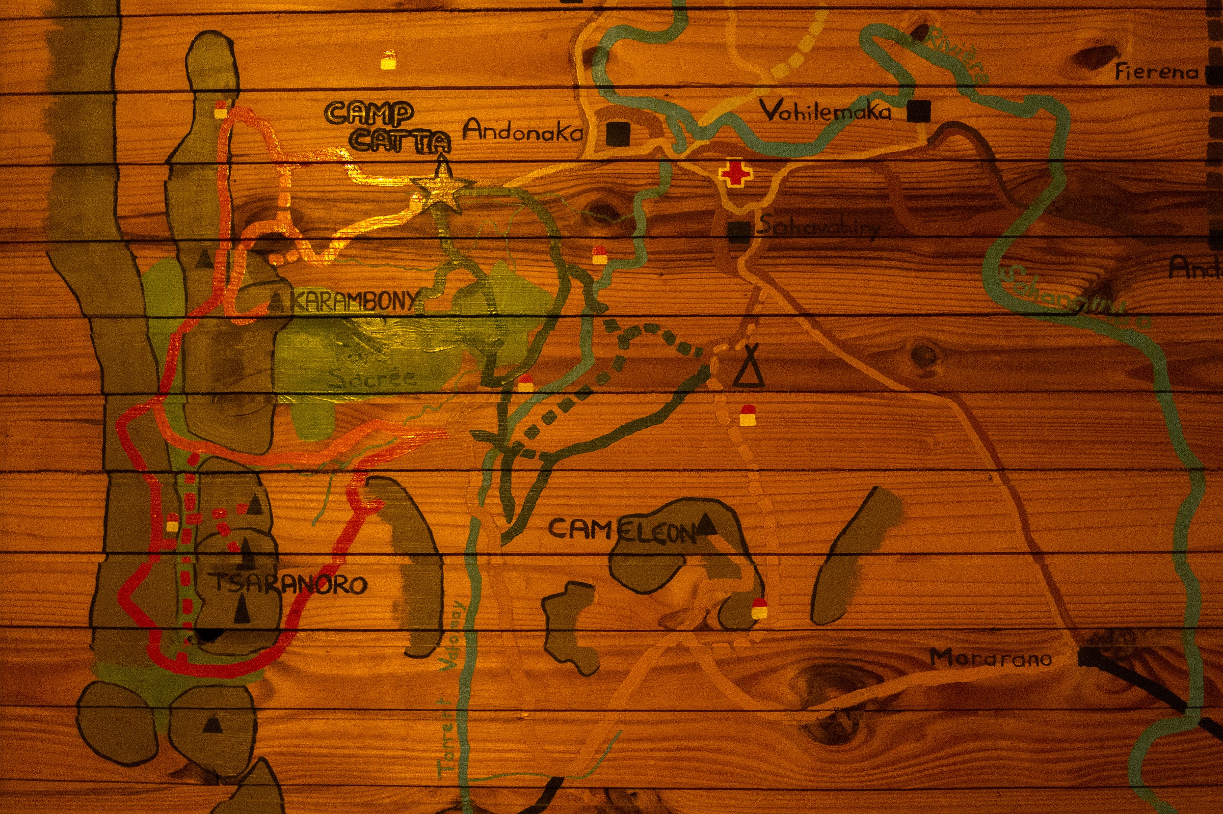
Andringitra is a fantastic place for hiking and climbing; from easy day walks to multi-day hikes. Just from the camp, you can approach the top of the “Chameleon” (6 hours return hike), stroll through the corridors of Tsaranoro (8h) with ample vegetation, or practice some free climbing at the boulders around the camp and the Tsaranoro sacred forest. The 800 m rough-textured granite rock of Tsaranoro is well known by free climbers worldwide. Around 30 open routes from difficulty level, 3 to 8b are available for experienced climbers. The multi-day treks are only available guided and requires overnight camping.

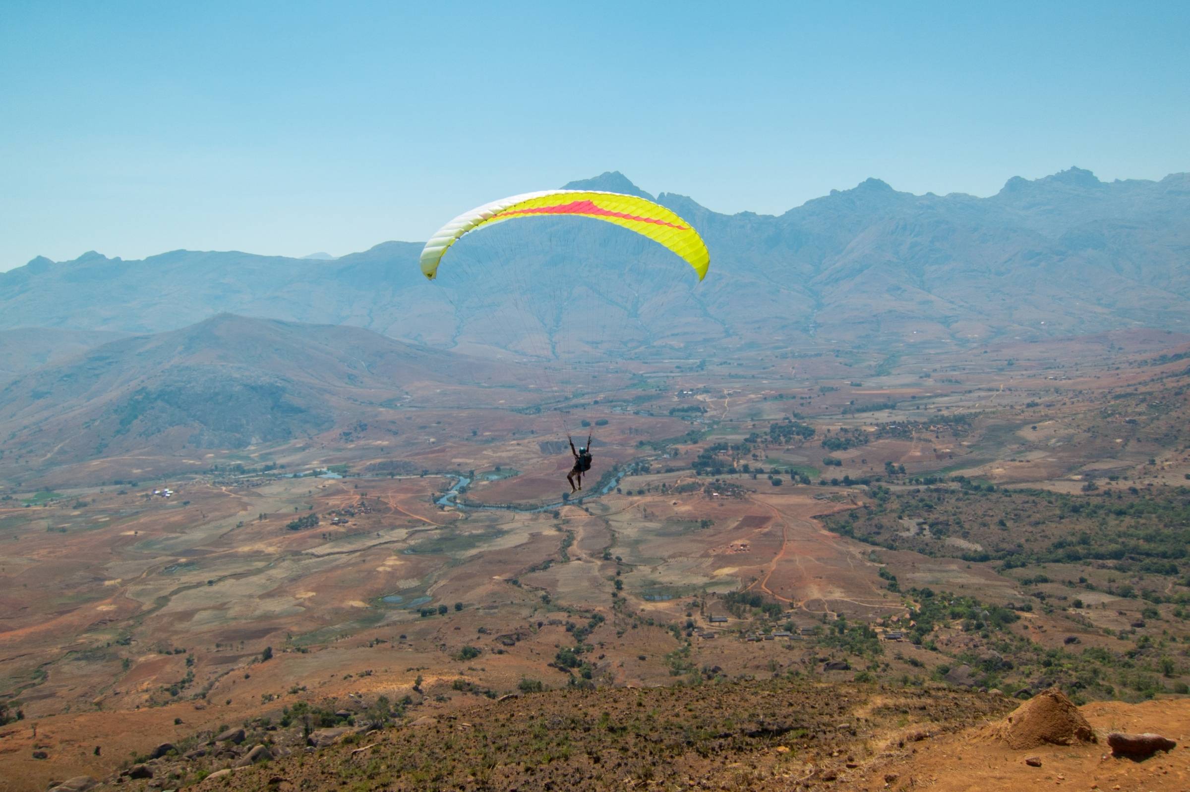
We hiked to the top of the "Chameleon" and the top of the "Karamboni". For the Karamboni hike, you need to be fit and experienced. At this time the trail was not well maintained, and some of the fixed metal ropes supporting the ascent were missing. Also, paragliding is possible from the Tsaranoro cliffs but you should avoid the months with strong blowing trade winds from July to August. The straight walls of the Tsaranoro massif let a few people start to try base jumping in 2003, and in 2012 the first base jump from Mount Karambony took place from a French team.
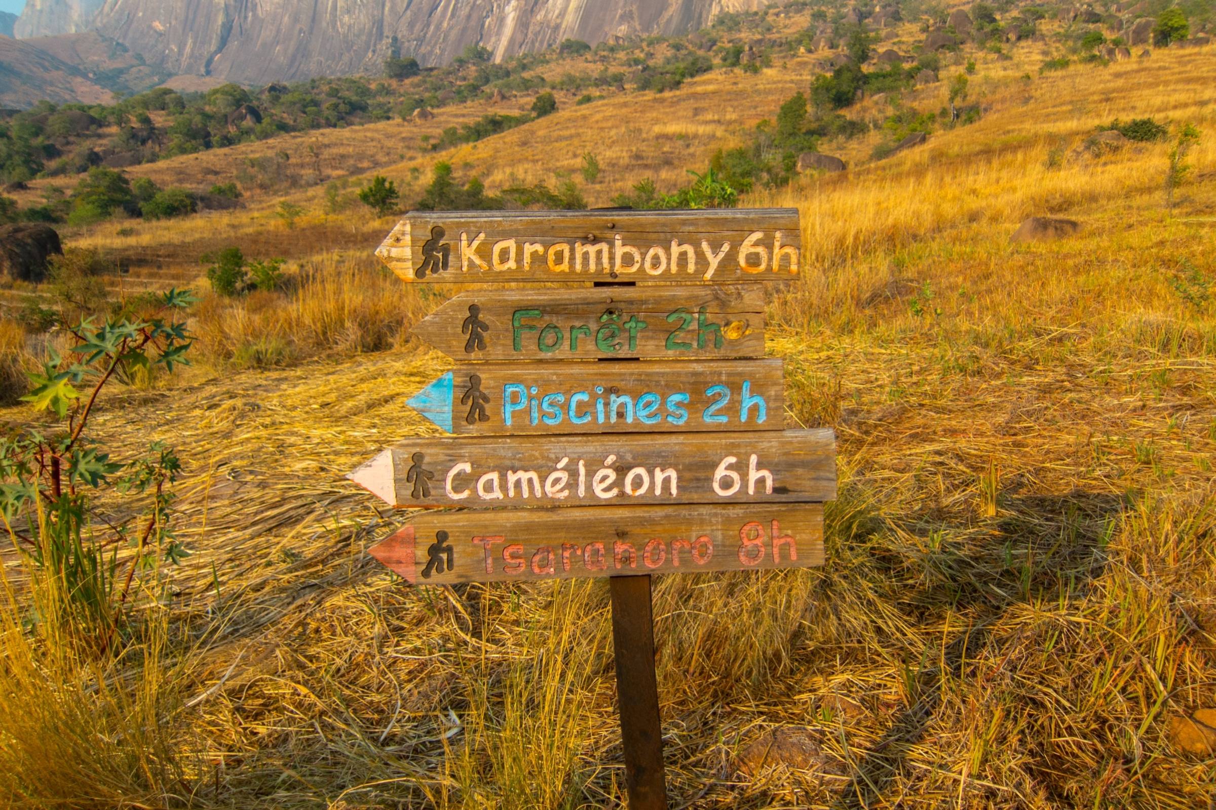
Hiking Trails

- Asaramanitra
Time: 4 h
Distance: 6km
What to expect: Hike through a dense forest with lush vegetation including orchids, chameleons, and a beautiful waterfall (300m/984ft) - Imaitso
Time: 8-9h
Distance: 14km
What to expect: Walking through a humid environment to approach a primary forest. On the way discover different birds and lemur species. From January to March you will observe plenty of orchids in full bloom. - Diavolana
Time: 10h
Distance: 13km
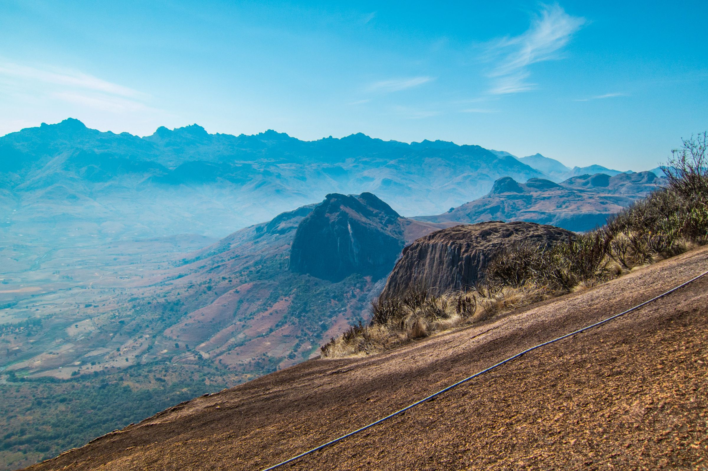
What to expect: Passing two sacred waterfalls (Riambavy, the queen and Riandahy, the king) falling 250m/820ft down from the escarpment. Expect not much water during the dry season. Strenuous and strong increasing ascend to 2100m/6889ft altitude. Passing forests and alpine meadows are covered by orchids in the rainy season. One of the most beautiful trails in the area. - Isahavato
Time: 12h
Distance: 15km
What to expect: Only for experienced hikers a trail to the high-altitude plateau Isahavato. Partly very steep ascend but you will pass a magnificent waterfall and if you include a night of camping you can enjoy a wonderful sunset as well. - Imarivolanitra
Time: 2-3 days
Distance: 28km
What to expect: Usually this hike to the top of Peak Boby requires two days. Starting from the campsite on the first day; the path follows the same trail as the Diavalona route. From there steep ascends are leading to the Andohariana plateau continuing to the next campsite. From here the last 3h to Peak Boby usually starts very early in the morning to be at the top for the sunrise.
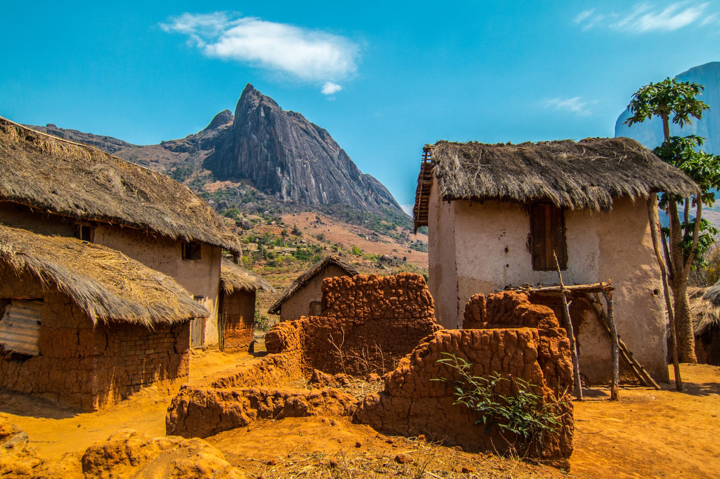
Where to Stay
There are several campsites in the park. The main campsite for both the Asaramanitra and the Diavalona trail is located at Belambo and is equipped with a kitchen, water, and toilet. The two-day hike to Peak Boby involves an overnight stay at the campsite of Andranolava (kitchen, water from the river, WC, no showers) and Andriampotsy campsites (with kitchen, water, WC and showers). For the Isahavato trail, you can overnight at the Iataranomby campsite which is equipped with a kitchen and a toilet. No showers or drinking water supply.
Outside of the National Park, you will find bungalows and tents at two lodges/camps:
- Camp Catta offers 4 different accommodation options from basic campsites to comfortable bungalows. The tent site is near a water supply point and a straw hut to eat in, the double tent is equipped with a foam mattress. Toilets and bathrooms with solar water heaters are shared. The traditional-designed bungalows equipped with twin beds and with the possibility to add a supplementary bed in the mezzanine, toilets and showers are either private or shared, and spacious bungalows build with a mix of stone and wood. They have one large or small twin bed and one or two more in the mezzanine, each is equipped with a toilet and bathrooms using solar water heaters.
- Tsara Camp offers accommodations in fully furnished tents. Each is equipped with double or twin beds with mosquito nets. 24/7 water supply heated by solar energy. Behind each tent is a small private bathroom with an outside shower and chemical toilet. Electricity is provided twice a day by a soundless generator from 6 to 8 am and from 5 to 10 pm.